Cover

9 Years of Excellence

Topographic Survey in RAJUK

Conduct RTK/Topographic Survey in RAJUK Jhlmil project area.

CLIENT:

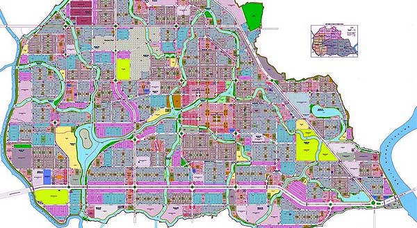
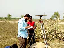
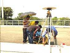
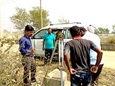
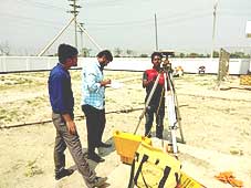
DSGS conducted a high precision RTK/topographic survey using an RTK GPS instrument to demarcate the Jhilmil Residential Park area in the RAJUK Jhilmil project area. The survey covered 155.81 acres of land and marked the boundary of the residential park with 36 pillars, the positions of which were digitally surveyed and recorded in maps. The survey aimed to provide accurate data for the demarcation of the park area, which will help in the planning and development of the residential park.


Services provided

  •   Geodetic Survey of total Boundary of the Project area by RTK GPS.

  •    Geodetic Survey of BNG apartment Boundary by RTK GPS.

  •    Establishment of 20 no’s of Temporary Bench Mark (TBM) from Survey of Bangladesh (SOB) pillar throughout the individual project area by Levelling Instrument.

  •    Digital Elevation Model (DEM) will be prepared in the surveyed area. Spot height by Total Station in 4 different zones in surveyed area. Data, Drawing, preparation.

  •    Digital Elevation Model (DEM) will be prepared in the surveyed area.

  •    Spot height by Total Station in 4 different zones in surveyed area.

  •    Data, Drawing, preparation.